
New York Marathon 2026 Route, Course Map, Times, Road Closures & Event Details
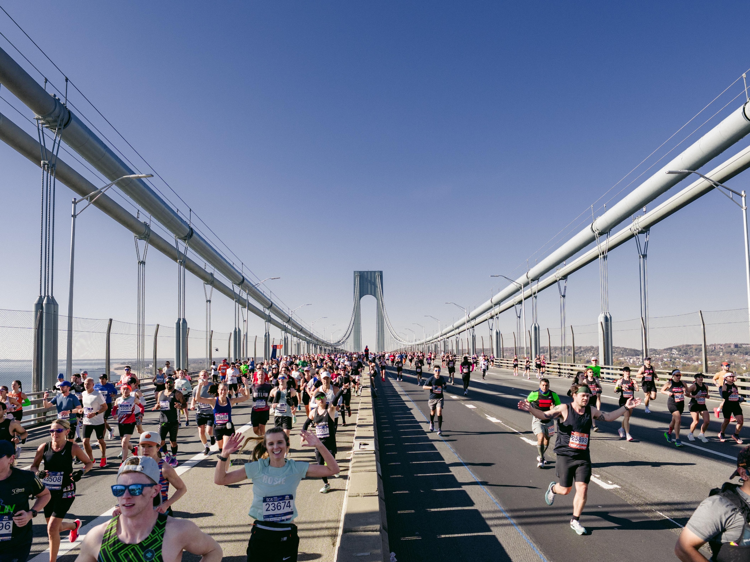
The 2026 TCS New York City Marathon will bring tens of thousands of runners and spectators to the streets of New York on Sunday, November 1. The 26.2-mile race travels through all five boroughs, starting on Staten Island and finishing in Manhattan's Central Park.
This year's event has particular significance: New York Road Runners (NYRR) is celebrating the 50th anniversary of the five-borough marathon route. The 2026 edition also introduces a minor but notable course adjustment in the Bronx, making it important for returning runners and spectators to check the latest map before race day.

Whether you're participating, supporting a runner, watching from the sidelines or simply trying to navigate the city, here's everything you need to know about the 2026 New York City Marathon.
Key Event Details
Date: Sunday, November 1, 2026
Start location: Fort Wadsworth, Staten Island
Finish location: Central Park, Manhattan
First wave start: 9:10 a.m. ET
Final wave start: 11:30 a.m. ET
The event begins with staggered starts throughout the morning, allowing runners to depart in five waves.
2026 Route and Course Map
The 2026 race follows its traditional five-borough course. It starts at Ford Wadsworth on Staten Island, crosses the Verrazzano-Narrows Bridge into Brooklyn, continues through Queens and the Bronx, and eventually returns to Manhattan for the finish in Central Park.
One of the most important changes to this year's marathon is the adjusted Bronx route. After crossing the Willis Avenue Bridge, runners will turn left onto East 135th Street, then right onto Alexander Avenue. They will continue along Alexander Avenue before turning left onto East 141st Street, followed by a left onto Third Avenue and a right onto East 138th Street. The route then crosses the Madison Avenue Bridge back into Manhattan.
Runners and spectators can view and download the latest course map through the New York Road Runners official course page. The page also provides an interactive Google Map showing course locations and race-day amenities.
Start Times
Wave 1: 9:10 a.m. ET
Wave 2: 9:45 a.m. ET
Wave 3: 10:20 a.m. ET
Wave 4: 10:55 a.m. ET
Wave 5: 11:30 a.m. ET
NYRR records official finishers through 10:00 p.m. ET.
Road and Bridge Closures
Several major bridges, avenues and local streets will close to accommodate runners, spectators, medical personnel and race operations.
Some restrictions also begin on Saturday, October 31 because of the Abbott Dash to the Finish Line 5K and marathon preparations.
City officials urge anyone trying to attend the race or just get around the city to take public transit.
Street Closures
Staten Island (Main Route)
- Staten Island Expressway
- Verrazzano-Narrows Bridge
- Additional Embargo Locations in Staten Island
Brooklyn (Main Route)
- Dahlgren Place between Verrazzano-Narrows Bridge and 92nd Street (Northbound)
- 92nd Street between Dahlgren Place and 4th Avenue
- 4th Avenue between 92nd Street and Flatbush Avenue
- Flatbush Avenue between 4th Avenue and Lafayette Avenue
- Lafayette Avenue between Flatbush Avenue and Bedford Avenue
- Bedford Avenue between Lafayette Avenue and Nassau Avenue
- Nassau Avenue between Bedford Avenue/Lorimer Street and Manhattan Avenue
- Manhattan Avenue between Nassau Avenue and Greenpoint Avenue
- Greenpoint Avenue between Manhattan Avenue and McGuinness Boulevard
- McGuinness Boulevard (Southbound) between Greenpoint Avenue and Pulaski Bridge
- Pulaski Bridge (Southbound)
- Additional Embargo Locations in Brooklyn
Queens (Main Route)
- 11th Street between Pulaski Bridge/Jackson Avenue and 48th Avenue
- 48th Avenue between 11th Street and Vernon Boulevard
- Vernon Boulevard between 48th Avenue and 10th Street
- 10th Street between Vernon Boulevard and 44th Drive
- 44th Drive between 10th Street and Hunter Street
- Hunter Street between 44th Drive and Crescent Street
- Crescent Street between Hunter Street and Queens Plaza South
- Queens Plaza South between Crescent Street and 23rd Street
- Queensboro Bridge (Eastbound)
- Additional Embargo Locations in Queens
Manhattan (Main Route)
- Queensboro Bridge (59th Street Pedestrian Entrance Ramp – Eastbound)
- East 59th Street between 2nd Avenue and 1st Avenue
- 1st Avenue between East 59th Street and Willis Avenue Bridge
- Additional Embargo Locations in Manhattan
Bronx (Main Route)
- Willis Avenue Bridge
- East 135th Street between Willis Avenue and Alexander Avenue
- Alexander Avenue between East 135th Street and East 141st Street
- East 141st Street between Alexander Avenue and 3rd Avenue
- 3rd Avenue between East 138th Street and East 141st Street
- East 138th Street between Morris Avenue and Madison Avenue Bridge
- Additional Embargo Locations in Bronx
Manhattan (Main Route – Continued)
- Madison Avenue Bridge (Westbound)
- East 138th Street between Madison Avenue and 5th Avenue
- 5th Avenue between 138th Street and 124th Street
- West 124th Street between 5th Avenue and Mount Morris Park West
- Mount Morris Park West between West 124th Street and West 120th Street
- West 120th Street between Mount Morris Park West and 5th Avenue
- 5th Avenue between 120th Street and 90th Street
- 90th Street between 5th Avenue and East Drive
- East Drive between 90th Street and Grand Army Plaza
- Grand Army Plaza between East Drive and West 59th Street
- West 59th Street between 5th Avenue and Columbus Circle/8th Avenue/Central Park West
- Columbus Circle between West 59th Street and Central Park Driveway
- Central Park Driveway/8th Avenue Approach to West Drive
- West Drive between 8th Avenue Approach and 67th Street Approach to West Drive
- Additional Embargo Locations in Manhattan
Additional closures affecting the family reunion area near the finish:
- Central Park West between Columbus Circle and West 81st Street
- West 63rd Street between Central Park West and Broadway
- West 64th Street between Central Park West and Broadway
- West 65th Street between Central Park West and Broadway
- West 66th Street between Central Park West and Broadway
- West 69th Street between Central Park West and Columbus Avenue
- West 70th Street between Central Park West and Columbus Avenue
- West 71st Street between Central Park West and Columbus Avenue
- West 72nd Street between Central Park West and Columbus Avenue
- West 74th Street between Central Park West and Columbus Avenue
- West 75th Street between Central Park West and Columbus Avenue
- West 76th Street between Central Park West and Columbus Avenue
- West 77th Street between Central Park West and Columbus Avenue
- Columbus Avenue between West 77th Street and Broadway
- Broadway between West 66th Street and Columbus Circle
- West 61st Street between Central Park West and Broadway
- West 62nd Street between Central Park West and Broadway
- West 67th Street between Central Park West and Columbus Avenue
- West 68th Street between Central Park West and Columbus Avenue
- West 73rd Street between Central Park West and Columbus Avenue
Bridge Closures
The Verrazzano-Narrows Bridge will experience the most significant restriction. It will be closed to traffic in both directions starting at 11:00 p.m. Saturday as crews prepare for the marathon.
The Bay Street and Lily Pond Avenue exits in Staten Island will close at 3:00 a.m. and reopen around 4:00 p.m.
Other bridge restrictions include:
- Pulaski Bridge: Closed from approximately 6:30 a.m. to 6:30 p.m.
- Queensboro Bridge: Lower level closed in both directions from approximately 6:30 a.m. to 5:30 p.m.
- Willis Avenue Bridge: Closed from approximately 7:30 a.m. to 6:30 p.m.
- Madison Avenue Bridge: Closed from approximately 7:30 a.m. to 6:30 p.m.